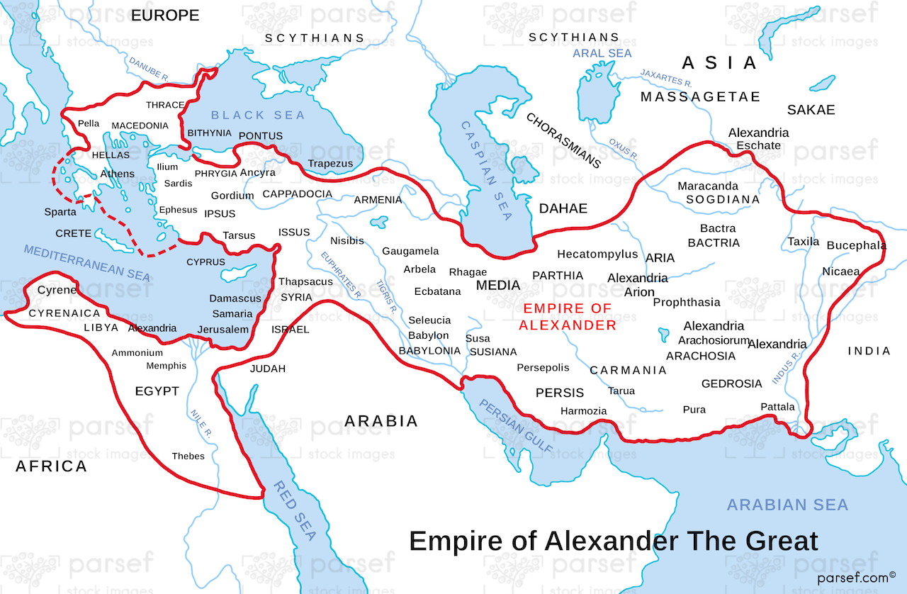
The Largest Empire of the Ancient World at Its Peak
Standing on the ruins of ancient Babylon, we tried to imagine the scale of Alexander's empire - stretching from the Ionian Sea to the Himalayan foothills. At its peak in 323 BCE, it covered over 2 million square miles. This map shows not just the territories he conquered, but how he connected them: building cities, establishing trade routes, and spreading Greek culture across three continents. We’ve traveled to many of these places - Egypt’s Alexandria, Turkey’s Gordium, Pakistan's Taxila - and each one tells a story of his vision. For travelers and historians alike, this map is your guide to understanding how one man’s ambition changed history forever.
Download High Resolution 300 DPI File Alexander the Great’s Empire Map