The Exodus route is one of the most debated geographies in the Bible, but that uncertainty is exactly why a clear map matters. Instead of pretending every stop is archaeologically fixed, a strong Exodus route map shows the traditional path, the major regions involved, and the logic behind the journey from Egypt into the wilderness.
What the Map Should Show
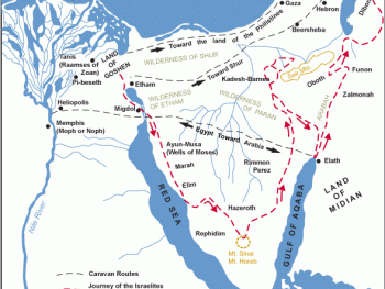
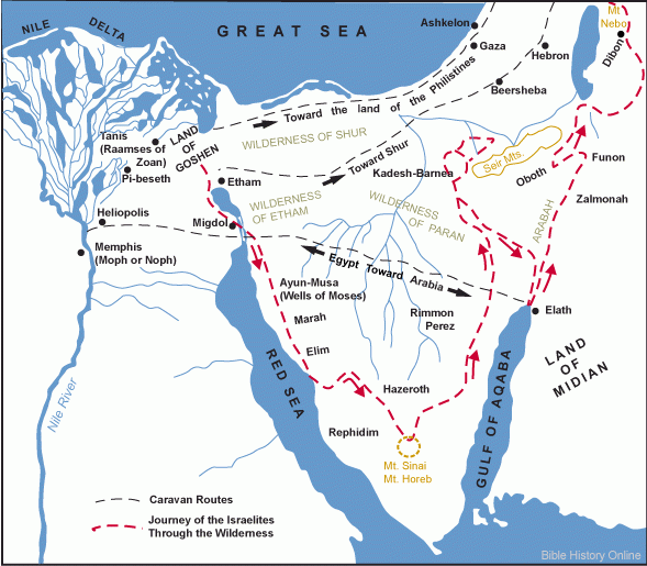
An Exodus route map should begin in the eastern Nile Delta, move through the region associated with the Sea crossing, and continue into the Sinai wilderness toward the mountain traditionally identified with Sinai. The goal is clarity, not overclaiming certainty.
Why the Route Is Debated
The biblical text names several stopping points, but many of them cannot be identified with confidence on a modern map. Different scholars place the crossing and Mount Sinai in different locations, which is why maps often present a traditional route rather than a universally accepted one.
The Value of a Visual Route
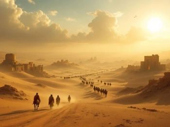
A map helps readers understand the scale of the journey in a way plain text often cannot. It shows that the Exodus is not a single dramatic escape scene but an extended movement through frontier landscapes, desert terrain, and transitional zones between empire and wilderness.
Key Regions to Label
The most useful labels include Goshen, the wilderness frontier east of Egypt, the sea-crossing zone, Marah, Elim, and the traditional Sinai region. Even when exact placement is uncertain, those labels help readers connect narrative events to a physical journey.
How to Handle Uncertainty
This page should openly state that the route shown is a traditional reconstruction. That approach builds trust, avoids overstating evidence, and still provides a practical, valuable map for readers interested in biblical geography.
Download High Resolution 300 DPI File Map of the Exodus Route Explained