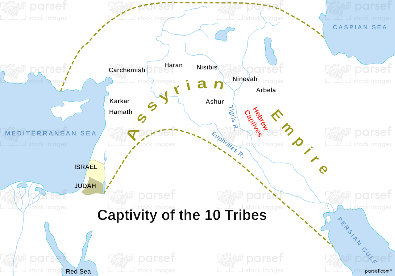
This map traces one of the most consequential events in Old Testament history: the fall of the northern Kingdom of Israel and the deportation of its ten tribes by the Assyrian Empire. After years of political instability and repeated warnings from prophets like Hosea and Amos, Samaria, the northern kingdom's capital, fell to Assyrian forces around 722 BC. The Assyrians then carried out a systematic policy of exile, resettling the Israelite population across various regions of their empire, including Halah, Habor, the Gozan river, and the cities of the Medes.
This map shows both the origin points within Israel's tribal territories and the destinations where these communities were scattered. The Assyrians used this displacement strategy widely to prevent conquered peoples from organizing rebellions, replacing them with settlers from other parts of their empire, a group whose descendants would later become known as the Samaritans. The fate of these ten tribes remains one of history's enduring mysteries, with the term "Lost Tribes of Israel" referring to their disappearance from biblical and historical record after this exile.
Use this map to understand the geography behind one of Israel's most significant national tragedies and its lasting impact on Jewish history.
Download High Resolution 300 DPI File Follow the exile of Israel’s northern kingdom into Assyria