Israel's Golden Age of Unity
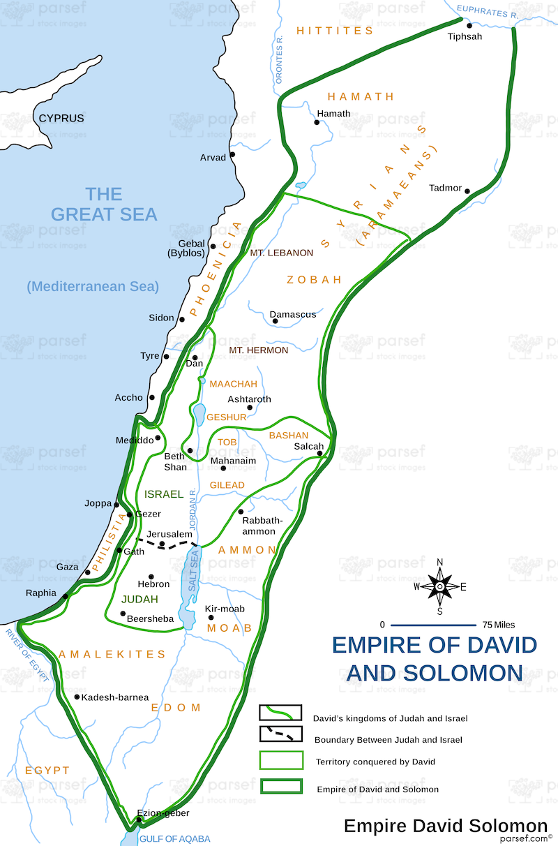
Under David and Solomon, Israel reached its peak as a united kingdom. We've stood on the hills of Jerusalem, where David captured the Jebusite stronghold and Solomon built the First Temple. This map traces their empire's borders - from the Euphrates River in the north to the Red Sea in the south - fulfilling God's promise to Abraham. David's military campaigns secured the land, while Solomon's trade alliances and building projects brought unprecedented prosperity. For travelers in Israel and Jordan, this map highlights sites like Megiddo, Gezer, and Hazor, where Solomon's administrative centers stood. It's a reminder of the kingdom that later split into Israel and Judah.
Download High Resolution 300 DPI File David and Solomon’s Empire Map