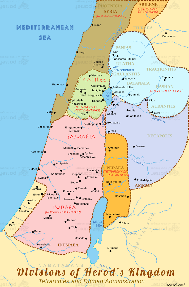
The Tetrarchy After Herod the Great
After Herod the Great's death in 4 BC, his kingdom was divided among his sons, reshaping the political landscape of Judea. We've walked the ruins of Herod's palaces in Jericho and Masada, and traced the borders of the territories inherited by his heirs. This map shows the tetrarchy: Archelaus ruled Judea, Samaria, and Idumea; Herod Antipas governed Galilee and Perea (where Jesus spent much of His ministry); and Philip controlled the northern regions of Iturea and Trachonitis. For New Testament readers, this division explains why Jesus was tried in Jerusalem (Archelaus' territory) but grew up in Nazareth (Antipas' domain). Travelers in Israel can use this map to understand the political backdrop of Jesus' life and ministry.
Download High Resolution 300 DPI File Divisions of Herod’s Kingdom Map